By now, I’m sure you’re all aware of the devastating tornado that tore through Adams County yesterday, destroying multiple wind turbines, carrying blades and other turbine debris hundreds of feet into the air, and causing at least one turbine to catch fire and burn. Witnesses have stated turbine blades and debris were strewn across a large area. The real tragedy, of course, was that multiple people in Greenfield lost their lives in this tornado. I’m sure all of you will join us in sending our hearts and prayers out to them and their loved ones.
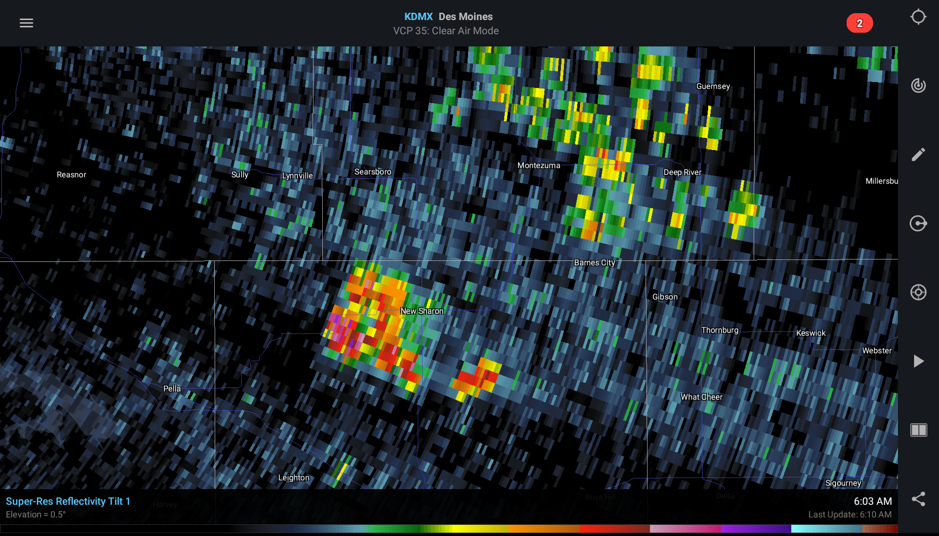
This tragedy does, however, bring up another serious concern about wind turbines — especially ones as tall as the ones NextEra is proposing to install here in Buchanan County. The following image is data I pulled from the National Weather Service Doppler radar in Des Moines on the morning of May 11th at 6:03 AM.

All of the yellows, oranges, reds, and purples you see here are phantoms. They are not thunderstorms. They are not even rain showers. They are wind turbines in the New Sharon and Montezuma areas interfering with NWS radar. This bears repeating: What you are looking at here are wind turbines effectively jamming the government’s Doppler weather radar, thus blinding the National Weather Service to any real threats that might be present above these areas.
Based on data gathered between 2018 and 2022, Buchanan County has the second highest number of tornadoes in Iowa, behind only Webster county. Doppler weather radar is vitally important to the safety of our citizens. Allowing 70 wind turbines, each nearly 600 feet tall, to come into our county will significantly degrade the ability of NWS to give us accurate warnings of impending severe weather threats, and thus degrade their ability to protect the citizens of our county.
Is this really what we want for Buchanan County?
